
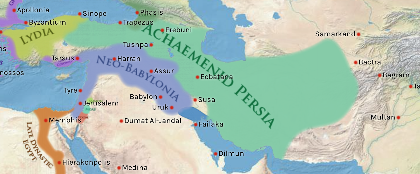
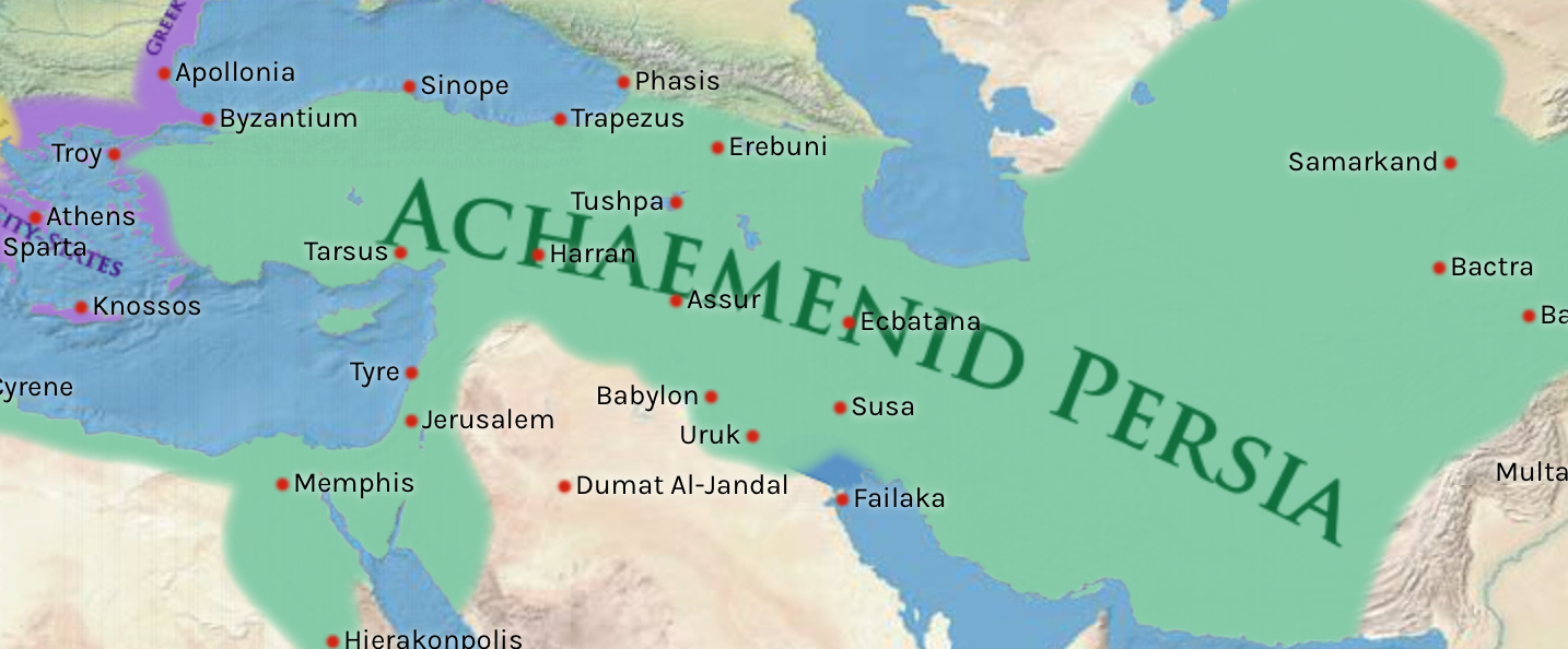
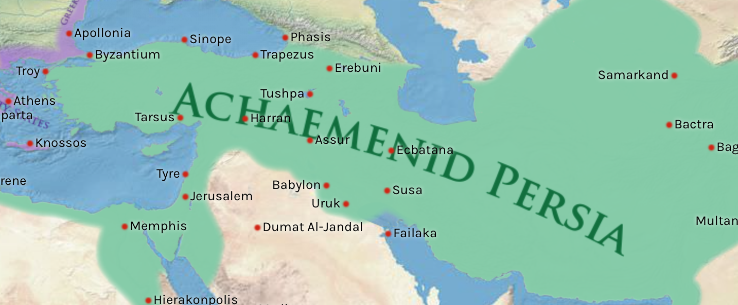
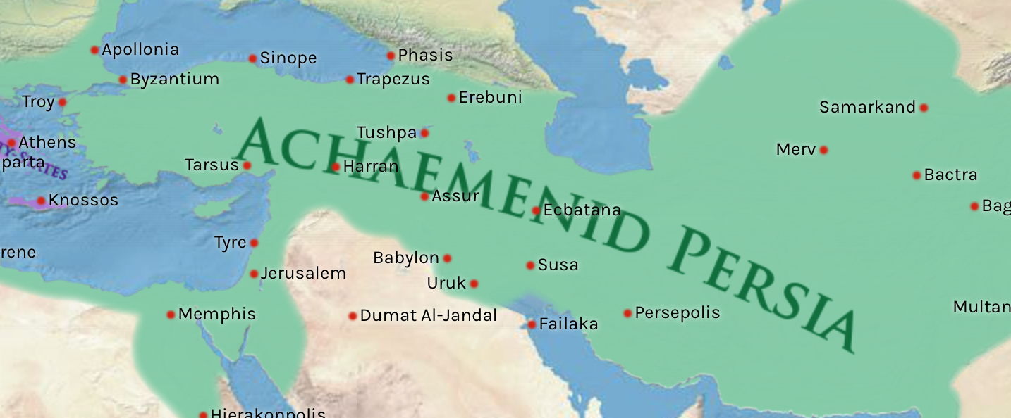
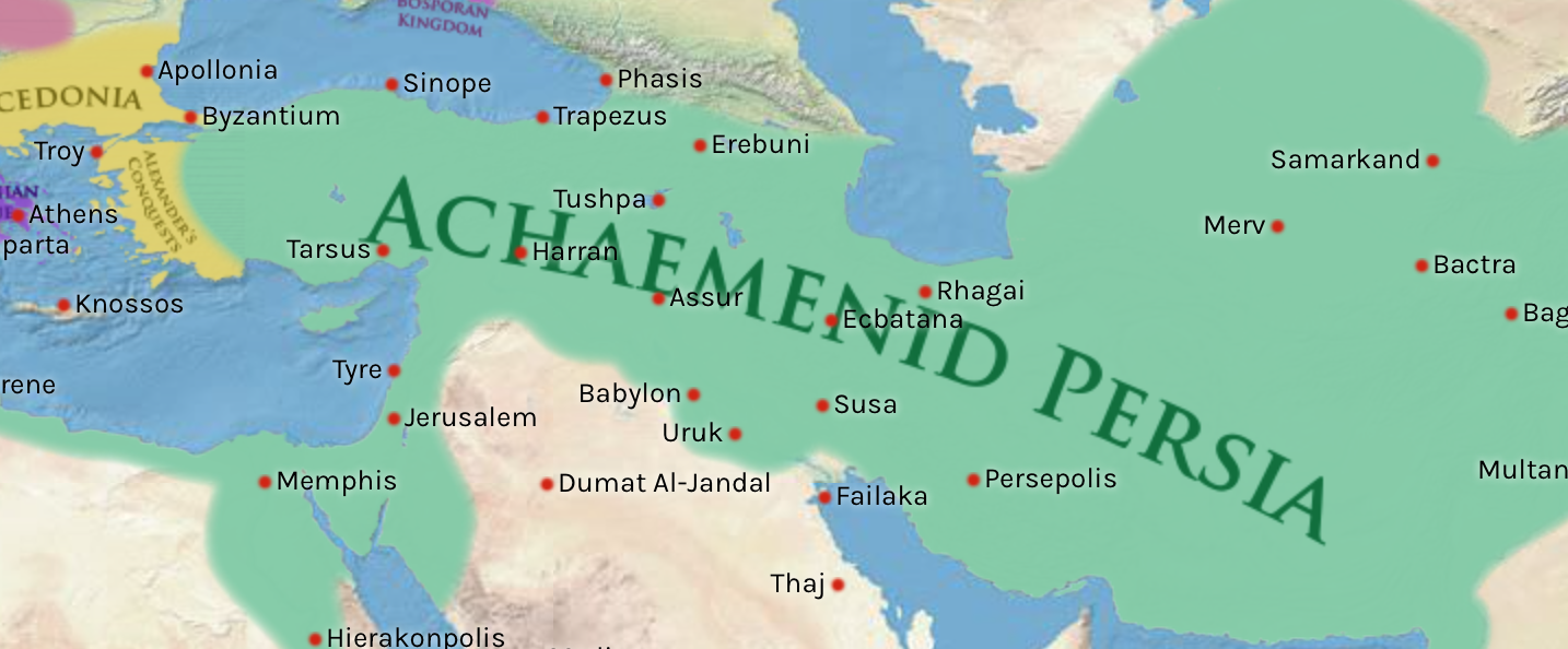
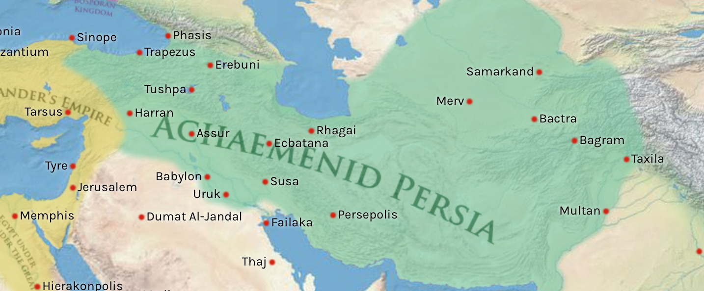
Picture: Map of the Persian Achaemenid Empire at its greatest extent under the reigns of Darius the Great and Xerxes. Inspired by Historical Atlas of Georges Duby (p.11, map D), this map was made by Fabienkhan the 24th of August 2006, using Inkscape and GIMP. Arad translated the map to help.
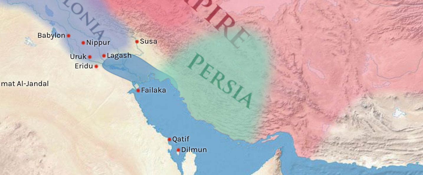
Cyrus II or Cyrus the great reformed the Persian tribal form to a federation of nations started in 552 BCE by a series of uprising against the governors of Mesopotamia and surrounding lands of his time. Medes were the first one who mutinied and joined Cyrus. Then came Lydia patched to the empire after a series of battles. Babylon’s gate were opened easily to Cyrus and many other cities.
Later Cambyses II, son of Cyrus the great added Egypt to the empire. Indus was merged to the empire during Darius I (Darius the great) and Xerxes expanded the empire to Greece and Macedonia.
Slide left on the below pictures to see how the Achaemenid Empire (first Persian Empire) boundaries changes over the time.
Left to right: 745 BCE, 605 BCE, 552 BCE, 545 BCE, 539 BCE, 525 BCE, 518 BCE, 513 BCE, 449 BCE, 334 BCE, 333 BCE, 332 BCE, 331 BCE


Leave a comment